Technologies
Tomographic SAR
Advanced 3D tomographic SAR analysis to monitor high-voltage transmission corridors in rural and remote areas. The dashboard reveals horizontal and vertical clearances, highlights operational risk, and helps teams prioritize targeted interventions that reduce outages, exposure, and operating costs.
3D radar intelligence for complex corridors
Resolve vertical structures, asset interactions and obstruction risk along strategic corridors where conventional 2D observation is not enough.
[Technology detail evidence eyebrow]
Tomographic evidence and dashboard outputs
Advanced 3D SAR tomography turns corridor monitoring into a decision-ready workflow, exposing horizontal and vertical clearances, highlighting risk, and helping operators plan targeted interventions that reduce downtime and operating cost.
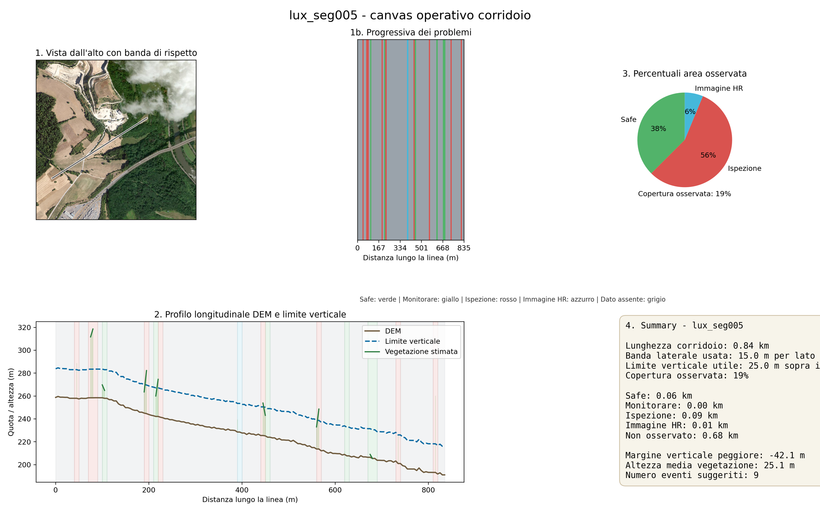
Corridor monitoring dashboard
Why it matters
Why tomographic SAR matters
Tomographic SAR extends radar analysis into the vertical dimension, helping teams distinguish complex scatterers, understand corridor occupation and monitor critical assets in environments where line-of-sight, terrain and structural complexity matter.
Capabilities
- Adds vertical discrimination that is especially valuable on complex infrastructure and corridor monitoring tasks.
- Improves visibility of encroachment and structural interaction around high-voltage assets.
- Helps prioritize maintenance and intervention planning using richer 3D radar evidence.
Best-fit applications
Where teams use this technology
These are some of the highest-value workflows that become practical when this capability is deployed inside XSensee.
High-voltage corridor obstruction monitoring
Detect conditions that may obstruct transmission corridors and increase the risk of service interruption.
Vegetation and structure proximity analysis
Assess how terrain, vegetation and built structures interact with linear assets in sensitive corridors.
Complex infrastructure scene interpretation
Support monitoring on dense industrial or engineered areas where vertical structure matters for risk evaluation.
Talk to the team
Want to see the technology mapped to your use case?
Tell us the territory, assets and decision problem you need to solve. We will map the right sensing and analytics workflow for your team.