Technologies
Interferometric SAR
XSensee uses interferometric SAR techniques to detect millimetric ground motion, subsidence and stability trends over critical areas, helping teams monitor terrain behaviour and infrastructure risk with all-weather continuity.
All-weather deformation monitoring at scale
Track ground motion, subsidence and instability trends over infrastructure, industrial zones, mines and critical territories with repeatable radar-based analytics.
[Technology detail evidence eyebrow]
Evidence and outputs
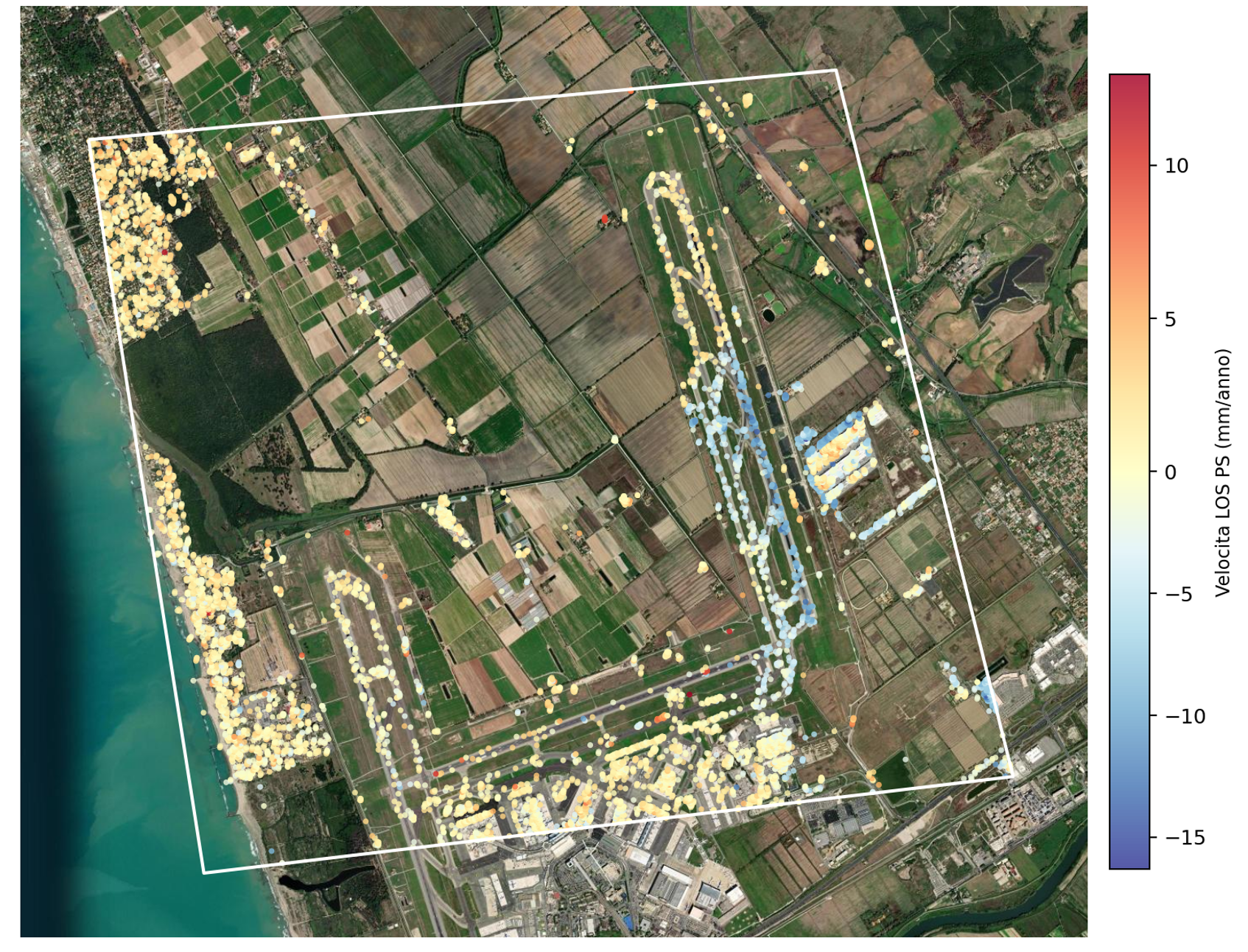
Review the SAR outputs as dashboards, profiles and map layers that support operational decisions.
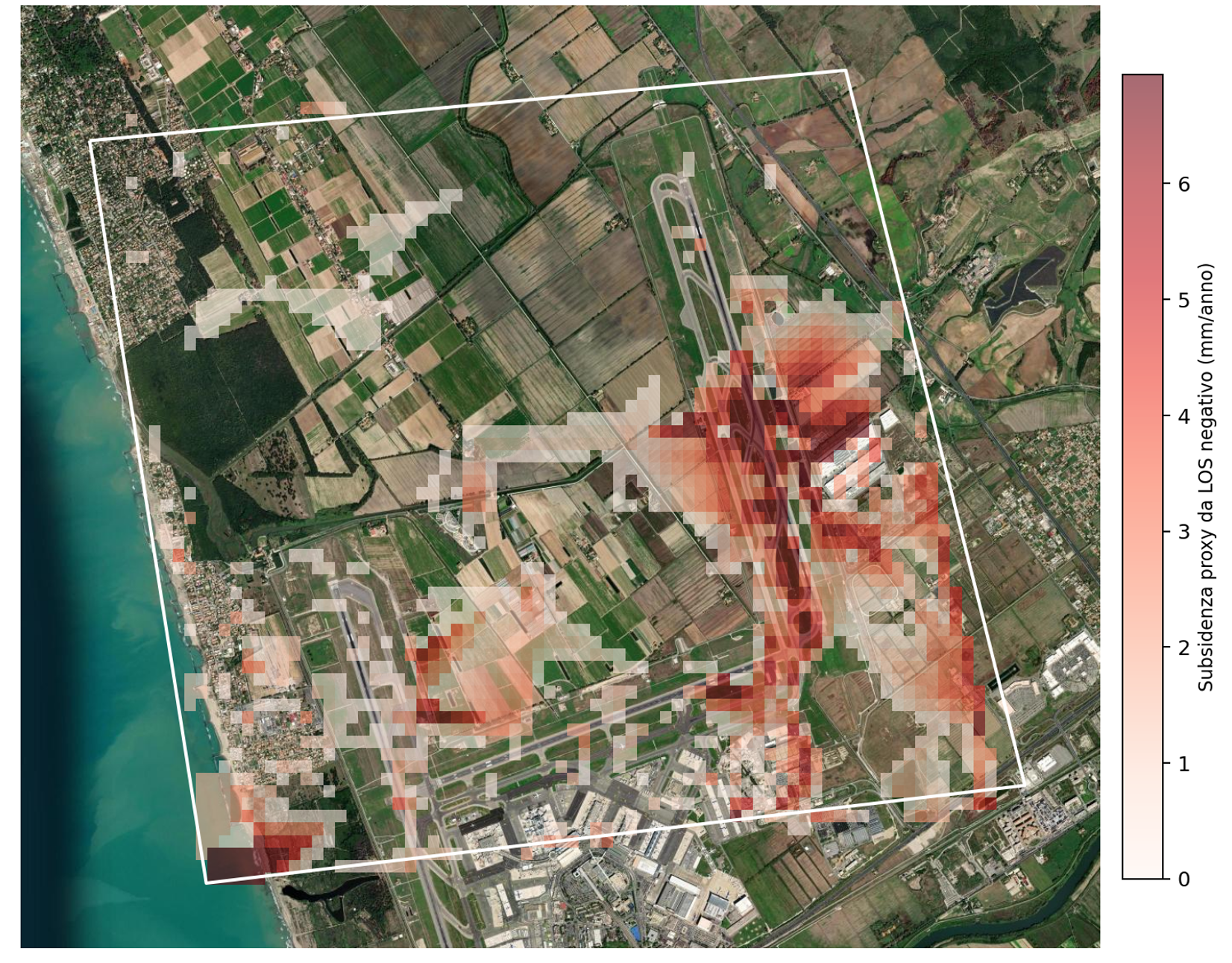
PSInSAR subsidence map
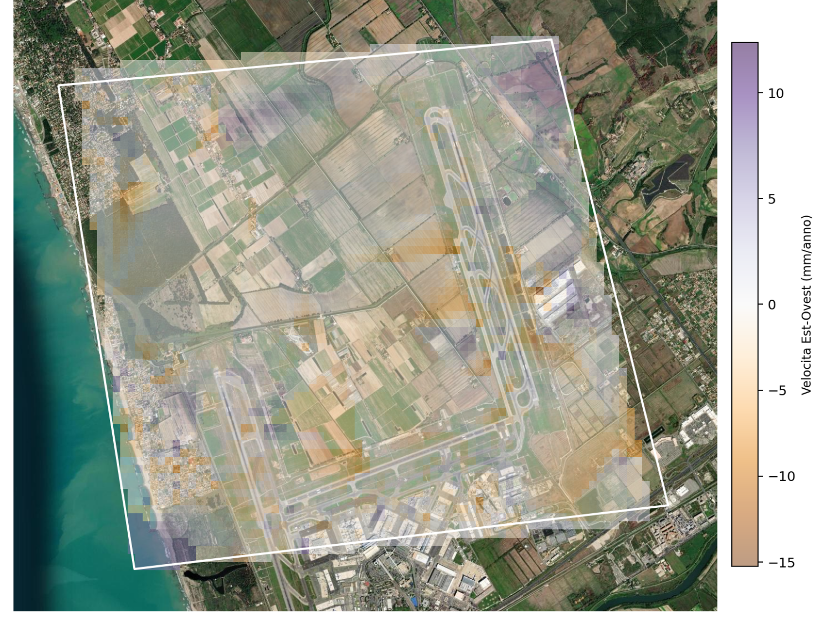
PSInSAR horizontal displacement map
Why it matters
Why interferometric SAR matters
Optical imagery shows surface appearance. Interferometric SAR adds a different layer of intelligence: how the ground and structures are moving over time. That makes it essential for risk, safety and long-term stability monitoring.
Capabilities
- Measures displacement and deformation trends even when cloud cover limits optical observation.
- Supports historical and repeated monitoring across large, geographically distributed assets.
- Helps teams prioritize inspections based on actual motion signals instead of only visual symptoms.
Best-fit applications
Where teams use this technology
These are some of the highest-value workflows that become practical when this capability is deployed inside XSensee.
Subsidence monitoring
Track gradual ground movement affecting urban areas, industrial zones and critical infrastructure corridors.
Open-pit mine stability
Monitor slope behaviour and deformation patterns that may indicate elevated operational or safety risk.
Critical infrastructure surveillance
Add deformation intelligence to monitoring workflows for strategic assets where stability and continuity are essential.
Talk to the team
Want to see the technology mapped to your use case?
Tell us the territory, assets and decision problem you need to solve. We will map the right sensing and analytics workflow for your team.